Configure Data for Geo Charts
To use geo charts in Analytical Designer, you must include the geographical information in your database as separate columns for longitute and latitude.
You can add geographical information to a current dataset in your logical data model or you can create a new dataset with the geographical information.
The dataset must include:
One field with the location name
The location name represents the name that is displayed in geo charts - for example, a city, a branch, or a store.
If the location name is not unique, set a unique identifier for the attribute and use the location name as the default label.One field with the latitude information
For latitude, use positive values for the Northern hemisphere and negative values for the Southern hemisphere. Do not include spaces.
One field with the longitude information
For longitude, use positive values for the Eastern hemisphere and negative values for the Western hemisphere. Do not include spaces.
Create a New Dataset with Geo Information
If you create a new dataset with geographical information, you must convert the geo information to the Geo latitude and Geo longitude labels and assign them to the location name of the attribute.
The labels are automatically mapped to appropriate source columns in the database.
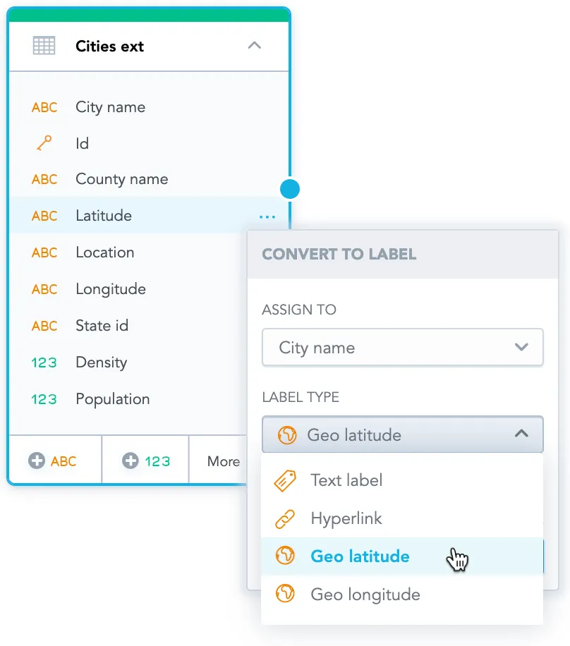
For more details, see the Convert Attribute or Fact to Label section in Manage Labels.
Add Geo Information to an Existing Dataset
If you add the geographical information to an existing dataset, you must manually add the latitude and longitude information as labels and map them to appropriate columns.
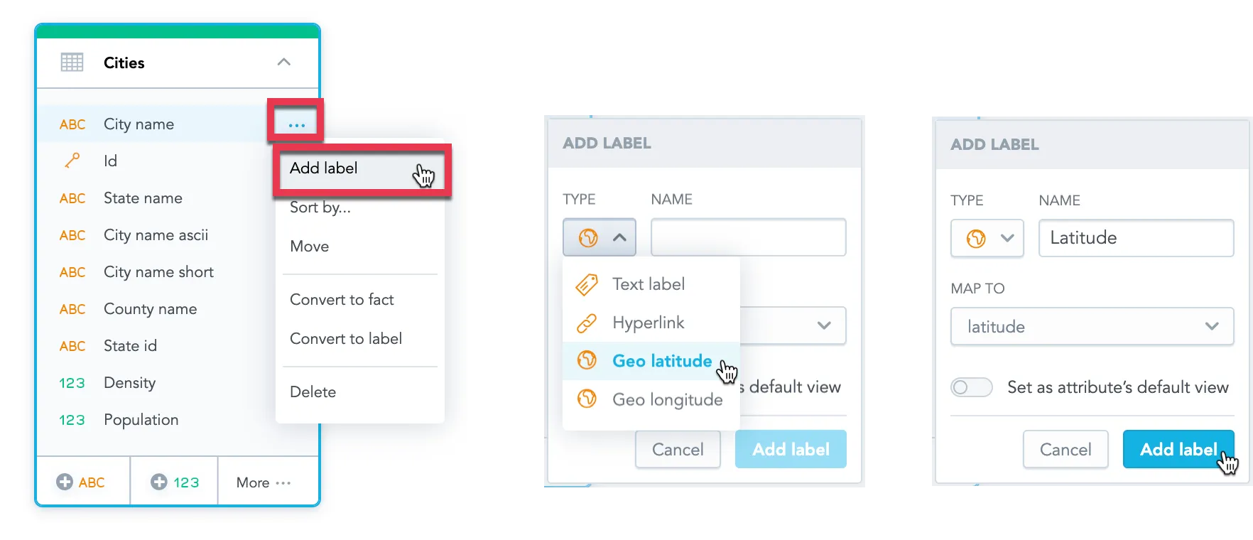
For more details, see the Add New Label section in Manage Labels.